Three oblique aerial photographs of the area during the 1920s
Three Aerial Photos
Copyrights are retained by the Dallas Public Library (Dallas, Texas, U.S.A.)
These pictures are scans of photographs from the collection of the downtown Dallas Public Library, Dallas History & Archives (7th floor).
Their permission was given for display of these images on this webpage but not for printed publication, nor for display on other internet websites.
|
|
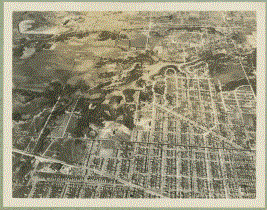
November 1924
(click on image for a larger view)
|
Oblique aerial photograph view taken on the 30th of November 1924, looking north --
showing the square mile area of the William Myers Section
and its surroundings (Dallas County, Texas).
|
|
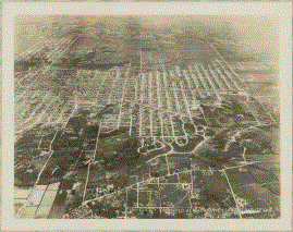
April 1926
(click on image for a larger view)
|
Oblique aerial photo taken on the 16th of April 1926, looking south
-- showing the square mile area of the William Myers Section
and western portions of Oak Cliff (Dallas County, Texas).
|
|
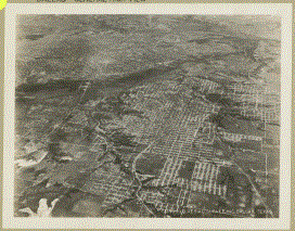
August 1928
(click on image for a larger view)
|
Oblique aerial photo taken on the 14th of August 1928, looking east
-- showing the square mile area of the William Myers Section,
downtown Dallas, and portions of Oak Cliff (Dallas County, Texas).
|
|
22 December 2023
Jim Barnes
|